Account: R0138094
April 5, 2026
| Account | Parcel | Account Type | Tax Year | Buildings | Actual Value | Local Govt Assessed Value | School Assessed Value |
|---|---|---|---|---|---|---|---|
| R0138094 | 121311000019 | Agricultural | 2026 | 89,507 | 24,170 | 24,160 |
| Legal |
|---|
| 11432 N2 11 3 65 EXC BEG W4 COR SEC N163.3' S62D40'E 352.6' S89D44'W 323.45' TO BEG ALSO EXC N89D44'E 403.45' OF W4 COR SEC N72D33'E 278.52' N35D01'E 134.44' S25D57'E 163.34' S22D50'E 48.54' S89D44'W 433.22' TO BEG ALSO EXC BEG NW COR SEC S0D07'W 2476.87' S62D40'E 352.52' N89D44'E 89.93' N72D33'E 278.52' N35D01'E 134.44' N35D24'E 216.6' N68D20'E 537.98' N65D10'E 219.53' N81D15'E 110.81' N05D06'E 430.24' S79D55'W 230.3' N21D06'W 321.08' N70D41'W 45.84' N05D24'W 258.01' N10D42'E 338.94' N31D38'W 325.93' N25D04'W 209.37' N10D11'W 228.87' TO N LN NW4 S88D40'W 1066.39' TO BEG |
| Subdivision | Block | Lot | Land Economic Area |
|---|---|---|---|
| TOWN RANGE 1213 RURAL |
| Property Address | Property City | Section | Township | Range |
|---|---|---|---|---|
| 16503 COUNTY ROAD 47 | WELD | 11 | 03 | 65 |
| Account | Parcel | Account Type | Tax Year | Buildings | Actual Value | Local Govt Assessed Value | School Assessed Value |
|---|---|---|---|---|---|---|---|
| R0138094 | 121311000019 | Agricultural | 2026 | 89,507 | 24,170 | 24,160 |
| Account | Owner Name | Address |
|---|---|---|
| R0138094 | ARISTOCRAT ANGUS RANCH LLP | 9053 COUNTY ROAD 34 PLATTEVILLE, CO 806519218 |
| Account | Parcel | Account Type | Tax Year | Buildings | Actual Value | Local Govt Assessed Value | School Assessed Value |
|---|---|---|---|---|---|---|---|
| R0138094 | 121311000019 | Agricultural | 2026 | 89,507 | 24,170 | 24,160 |
| Reception | Rec Date | Type | Grantor | Grantee | Doc Fee | Sale Date | Sale Price |
|---|---|---|---|---|---|---|---|
| 02147158 | 07-06-1988 | WDN | BEEBE DRAW LAND COMPANY LTD | ARISTOCRAT ANGUS RANCH | 0.00 | 07-05-1988 | 0 |
*If the hyperlink for the reception number does not work, try a manual search in the Clerk and Recorder records. Use the Grantor or Grantee in your search.
| Account | Parcel | Account Type | Tax Year | Buildings | Actual Value | Local Govt Assessed Value | School Assessed Value |
|---|---|---|---|---|---|---|---|
| R0138094 | 121311000019 | Agricultural | 2026 | 89,507 | 24,170 | 24,160 |
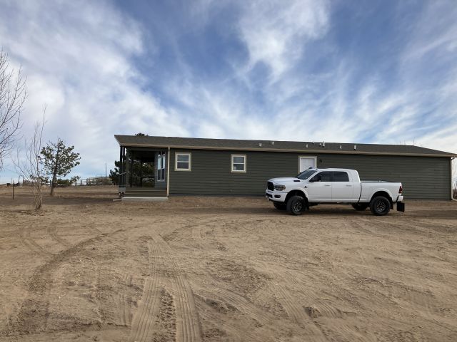
No buildings found.
| Account | Parcel | Account Type | Tax Year | Buildings | Actual Value | Local Govt Assessed Value | School Assessed Value |
|---|---|---|---|---|---|---|---|
| R0138094 | 121311000019 | Agricultural | 2026 | 89,507 | 24,170 | 24,160 |
| Type | Code | Description | Actual Value | Local Govt Assessed Value | School Assessed Value | Acres | Land SqFt |
|---|---|---|---|---|---|---|---|
| Land | 4107 | SPRINKLER IRRIGATED LAND | 84,259 | 22,750 | 22,750 | 165.000 | 7,187,400 |
| Land | 4147 | GRAZING LAND-AGRICULTURAL | 5,235 | 1,410 | 1,410 | 70.940 | 3,090,146 |
| Land | 4167 | WASTE LAND | 13 | 10 | 0 | 5.680 | 247,421 |
| Totals | - | - | 89,507 | 24,170 | 24,160 | 241.620 | 10,524,967 |
Comparable sales for your Residential or Commercial property may be found using our SALES SEARCH TOOL
Values are updated annually on May 1st for Real Property and June 15th for Personal Property and Oil and Gas.
| Account | Parcel | Account Type | Tax Year | Buildings | Actual Value | Local Govt Assessed Value | School Assessed Value |
|---|---|---|---|---|---|---|---|
| R0138094 | 121311000019 | Agricultural | 2026 | 89,507 | 24,170 | 24,160 |
| Tax Area | District ID | District Name | Local Govt Mill Levy |
School Mill Levy |
Estimated Taxes |
|---|---|---|---|---|---|
| 2181 | 0700 | AIMS JUNIOR COLLEGE | 6.313 | 0.000 | $152.59 |
| 2181 | 0302 | CENTRAL COLORADO WATER (CCW) | 0.980 | 0.000 | $23.69 |
| 2181 | 0309 | CENTRAL COLORADO WATER SUBDISTRICT (CCS) | 1.462 | 0.000 | $35.34 |
| 2181 | 1050 | HIGH PLAINS LIBRARY | 3.044 | 0.000 | $73.57 |
| 2181 | 0511 | LASALLE FIRE | 5.154 | 0.000 | $124.57 |
| 2181 | 1201 | PLATTE VALLEY CONSERVATION | 0.000 | 0.000 | $0.00 |
| 2181 | 0201 | SCHOOL DIST RE1-GILCREST | 0.000 | 15.382 | $371.63 |
| 2181 | 0100 | WELD COUNTY | 15.956 | 0.000 | $385.66 |
| Total | - | - | 32.909 | 15.382 | $1,167.04 |
The estimate of tax is based on the prior year mill levy and the 2025 projected assessment rates. Mill levies and tax estimates will be updated yearly on December 22nd for the current year. Additional information can be found at https://assessor.weld.gov