Account: R0574586
April 1, 2026
| Account | Parcel | Account Type | Tax Year | Buildings | Actual Value | Local Govt Assessed Value | School Assessed Value |
|---|---|---|---|---|---|---|---|
| R0574586 | 054528206004 | Residential | 2026 | 1 | 33,062 | 2,070 | 2,330 |
| Legal |
|---|
| 6359 L16 BLK7 BRIGGSDALE AND VACATED N20' MAIN ST ADJ TO |
| Subdivision | Block | Lot | Land Economic Area |
|---|---|---|---|
| BRIGGSDALE TOWN | 7 | 16 | BRIGGSDALE |
| Property Address | Property City | Section | Township | Range |
|---|---|---|---|---|
| 221 MAIN ST | WELD | 28 | 08 | 62 |
| Account | Parcel | Account Type | Tax Year | Buildings | Actual Value | Local Govt Assessed Value | School Assessed Value |
|---|---|---|---|---|---|---|---|
| R0574586 | 054528206004 | Residential | 2026 | 1 | 33,062 | 2,070 | 2,330 |
| Account | Owner Name | Address |
|---|---|---|
| R0574586 | ALLSHOUSE RALPH C | 225 MAIN ST BRIGGSDALE, CO 806118929 |
| R0574586 | ALLSHOUSE NANCY J |
| Account | Parcel | Account Type | Tax Year | Buildings | Actual Value | Local Govt Assessed Value | School Assessed Value |
|---|---|---|---|---|---|---|---|
| R0574586 | 054528206004 | Residential | 2026 | 1 | 33,062 | 2,070 | 2,330 |
| Reception | Rec Date | Type | Grantor | Grantee | Doc Fee | Sale Date | Sale Price |
|---|---|---|---|---|---|---|---|
| 01904636 | 09-24-1982 | QCN | 0.00 | 01-01-1900 | 0 | ||
| 155810 | NA | SUB | SUBDIVISION | BRIGGSDALE | 0.00 | NA | 0 |
| 3574310 | 08-25-2008 | AFFD | FREEMYER ALVIN B & FREEMYER MILDRED L | FREEMYER MILDRED L | 0.00 | 08-01-2008 | 0 |
| 3992736 | 01-28-2014 | QCN | FREEMYER MILDRED L | ALLSHOUSE RALPH C | 0.00 | 01-06-2014 | 0 |
*If the hyperlink for the reception number does not work, try a manual search in the Clerk and Recorder records. Use the Grantor or Grantee in your search.
| Account | Parcel | Account Type | Tax Year | Buildings | Actual Value | Local Govt Assessed Value | School Assessed Value |
|---|---|---|---|---|---|---|---|
| R0574586 | 054528206004 | Residential | 2026 | 1 | 33,062 | 2,070 | 2,330 |
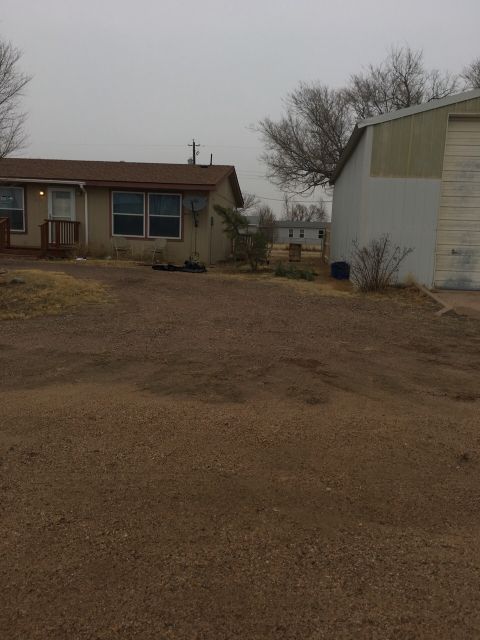
Building 1
| AccountNo | Building ID | Occupancy |
|---|---|---|
| R0574586 | 1 | Detached Garage |
| ID | Type | NBHD | Occupancy | % Complete | Bedrooms | Baths |
|---|---|---|---|---|---|---|
| 1 | Residential | 7R0003 | Detached Garage | 100 | 0 | 0.00 |
| ID | Exterior | Roof Cover | Interior | HVAC | Perimeter | Units | Unit Type | Make |
|---|---|---|---|---|---|---|---|---|
| 1 | Frame Aluminum | NA | NA | None | 128 | 0 | NA | NA |
| ID | Square Ft | Condo SF | Total Basement SF | Finished Basement SF | Garage SF | Carport SF | Balcony SF | Porch SF |
|---|---|---|---|---|---|---|---|---|
| 1 | 960 | 0 | 0 | 0 | 0 | 0 | 0 | 0 |
| ID | Built As | Square Ft | Year Built | Stories | Length | Width |
|---|---|---|---|---|---|---|
| 1.00 | Detached Garage | 960 | 1982 | 1 | 0 | 0 |
No Additional Details for Building 1
| Account | Parcel | Account Type | Tax Year | Buildings | Actual Value | Local Govt Assessed Value | School Assessed Value |
|---|---|---|---|---|---|---|---|
| R0574586 | 054528206004 | Residential | 2026 | 1 | 33,062 | 2,070 | 2,330 |
| Type | Code | Description | Actual Value | Local Govt Assessed Value | School Assessed Value | Acres | Land SqFt |
|---|---|---|---|---|---|---|---|
| Improvement | 1212 | SINGLE FAMILY RESIDENTIAL IMPROVEMENTS | 25,562 | 1,600 | 1,800 | 0.000 | 0 |
| Land | 1112 | SINGLE FAMILY RESIDENTIAL-LAND | 7,500 | 470 | 530 | 0.086 | 3,750 |
| Totals | - | - | 33,062 | 2,070 | 2,330 | 0.086 | 3,750 |
Comparable sales for your Residential or Commercial property may be found using our SALES SEARCH TOOL
Values are updated annually on May 1st for Real Property and June 15th for Personal Property and Oil and Gas.
| Account | Parcel | Account Type | Tax Year | Buildings | Actual Value | Local Govt Assessed Value | School Assessed Value |
|---|---|---|---|---|---|---|---|
| R0574586 | 054528206004 | Residential | 2026 | 1 | 33,062 | 2,070 | 2,330 |
| Tax Area | District ID | District Name | Local Govt Mill Levy |
School Mill Levy |
Estimated Taxes |
|---|---|---|---|---|---|
| 1007 | 0700 | AIMS JUNIOR COLLEGE | 6.313 | 0.000 | $13.07 |
| 1007 | 0524 | BRIGGSDALE FIRE | 4.002 | 0.000 | $8.28 |
| 1007 | 1050 | HIGH PLAINS LIBRARY | 3.044 | 0.000 | $6.30 |
| 1007 | 0210 | SCHOOL DIST RE10J-BRIGGSDALE | 0.000 | 16.616 | $38.72 |
| 1007 | 0100 | WELD COUNTY | 15.956 | 0.000 | $33.03 |
| 1007 | 1200 | WEST GREELEY CONSERVATION | 0.414 | 0.000 | $0.86 |
| Total | - | - | 29.729 | 16.616 | $100.25 |
The estimate of tax is based on the prior year mill levy and the 2025 projected assessment rates. Mill levies and tax estimates will be updated yearly on December 22nd for the current year. Additional information can be found at https://assessor.weld.gov