Account: R2769086
April 4, 2026
| Account | Parcel | Account Type | Tax Year | Buildings | Actual Value | Local Govt Assessed Value | School Assessed Value |
|---|---|---|---|---|---|---|---|
| R2769086 | 096105101001 | Agricultural | 2026 | 2 | 120,439 | 7,550 | 8,510 |
| Legal |
|---|
| 12132 L8 & PT OF L7 NE4NE4 5 5 65 BEG S85D40'W 430' OF NE COR L7 S1D30'W 145' S38DE 230' S8D30'W 200' S47D20'W 168' S1D30'W 33' TO S LN L7 E430' TO SE COR N TO NE COR W TO BEG EXC BEG AT PT 305' S OF NE COR L8 SWLY 125' TO E BDRY OF RD ELY 30' TO E BDRY L8 139.5' SLY FROM BEG N139.5' TO BEG EXC US85 BY PASS (4.44A) |
| Subdivision | Block | Lot | Land Economic Area |
|---|---|---|---|
| GREELEY RURAL |
| Property Address | Property City | Section | Township | Range |
|---|---|---|---|---|
| 109 N 1ST AVE | WELD | 05 | 05 | 65 |
| Account | Parcel | Account Type | Tax Year | Buildings | Actual Value | Local Govt Assessed Value | School Assessed Value |
|---|---|---|---|---|---|---|---|
| R2769086 | 096105101001 | Agricultural | 2026 | 2 | 120,439 | 7,550 | 8,510 |
| Account | Owner Name | Address |
|---|---|---|
| R2769086 | ARNOLD PATRICK J (45.8335% INT) | 1951 E US HIGHWAY 34 GREELEY, CO 806319711 |
| R2769086 | ARNOLD DAWN MICHELLE (8.333% INT) | |
| R2769086 | WHITE JUDITH ANN (45.8335% INT) |
| Account | Parcel | Account Type | Tax Year | Buildings | Actual Value | Local Govt Assessed Value | School Assessed Value |
|---|---|---|---|---|---|---|---|
| R2769086 | 096105101001 | Agricultural | 2026 | 2 | 120,439 | 7,550 | 8,510 |
| Reception | Rec Date | Type | Grantor | Grantee | Doc Fee | Sale Date | Sale Price |
|---|---|---|---|---|---|---|---|
| 01745863 | 02-28-1978 | PRDN | 0.00 | 01-01-1900 | 0 | ||
| 1385163 | 07-06-1962 | COZ | WELD COUNTY ZONING | CASE: Z-22 ZONING I-3 | 0.00 | NA | 0 |
| 1385163 | 07-06-1962 | COZ | WELD COUNTY ZONING | CASE: Z-22 ZONING C-3 | 0.00 | NA | 0 |
| 1385163 | 07-06-1962 | COZ | WELD COUNTY ZONING | CASE: Z-22 ZONING R-1 | 0.00 | NA | 0 |
| 3224162 | 10-01-2004 | QCN | ARNOLD JERRY | ARNOLD GERALD J & | 0.00 | 09-29-2004 | 0 |
| 3668506 | 01-05-2010 | DTHC | ARNOLD GERALD JAMES DEATH CERT | ARNOLD DOROTHY M | 0.00 | 01-05-2010 | 0 |
| 3668507 | 01-05-2010 | AFFD | ARNOLD GERALD JAMES | ARNOLD DOROTHY M | 0.00 | 01-05-2010 | 0 |
| 39743 | NA | SUB | SUBDIVISION | UNION COLONY LANDS | 0.00 | NA | 0 |
| 4538969 | 11-06-2019 | PRDN | ARNOLD DOROTHY M | ARNOLD PATRICK J (45.8335% INT); WHITE JUDITH ANN (45.8335% INT); ARNOLD et al. | 0.00 | 11-01-2019 | 0 |
*If the hyperlink for the reception number does not work, try a manual search in the Clerk and Recorder records. Use the Grantor or Grantee in your search.
| Account | Parcel | Account Type | Tax Year | Buildings | Actual Value | Local Govt Assessed Value | School Assessed Value |
|---|---|---|---|---|---|---|---|
| R2769086 | 096105101001 | Agricultural | 2026 | 2 | 120,439 | 7,550 | 8,510 |
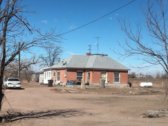
Building 1
| AccountNo | Building ID | Occupancy |
|---|---|---|
| R2769086 | 1 | Single Family Residential on Ag |
| ID | Type | NBHD | Occupancy | % Complete | Bedrooms | Baths |
|---|---|---|---|---|---|---|
| 1 | Residential | 6G1036 | Single Family Residential on Ag | 100 | 2 | 1.00 |
| ID | Exterior | Roof Cover | Interior | HVAC | Perimeter | Units | Unit Type | Make |
|---|---|---|---|---|---|---|---|---|
| 1 | Frame Masonry Veneer | Composition Shingle | Drywall | None | NA | 0 | NA | NA |
| ID | Square Ft | Condo SF | Total Basement SF | Finished Basement SF | Garage SF | Carport SF | Balcony SF | Porch SF |
|---|---|---|---|---|---|---|---|---|
| 1 | 1,310 | 0 | 0 | 0 | 0 | 0 | 0 | 66 |
| ID | Built As | Square Ft | Year Built | Stories | Length | Width |
|---|---|---|---|---|---|---|
| 1.00 | Ranch 1 Story | 1,310 | 1890 | 1 | 0 | 0 |
| ID | Detail Type | Description | Units |
|---|---|---|---|
| 1 | Fixture | Full Bath | 1.00 |
| 1 | Porch | Open Slab | 66.00 |
Building 2
| AccountNo | Building ID | Occupancy |
|---|---|---|
| R2769086 | 2 | Shed - Utility |
| ID | Type | NBHD | Occupancy | % Complete | Bedrooms | Baths |
|---|---|---|---|---|---|---|
| 2 | Out Building | NA | Shed - Utility | 100 | 0 | 0.00 |
| ID | Exterior | Roof Cover | Interior | HVAC | Perimeter | Units | Unit Type | Make |
|---|---|---|---|---|---|---|---|---|
| 2 | NA | NA | NA | None | 0 | 0 | NA | NA |
| ID | Square Ft | Condo SF | Total Basement SF | Finished Basement SF | Garage SF | Carport SF | Balcony SF | Porch SF |
|---|---|---|---|---|---|---|---|---|
| 2 | 1 | 0 | 0 | 0 | 0 | 0 | 0 | 0 |
| ID | Built As | Square Ft | Year Built | Stories | Length | Width |
|---|---|---|---|---|---|---|
| 2.00 | Shed - Utility | 1 | 0 | 0 | 0 | 0 |
No Additional Details for Building 2
| Account | Parcel | Account Type | Tax Year | Buildings | Actual Value | Local Govt Assessed Value | School Assessed Value |
|---|---|---|---|---|---|---|---|
| R2769086 | 096105101001 | Agricultural | 2026 | 2 | 120,439 | 7,550 | 8,510 |
| Type | Code | Description | Actual Value | Local Govt Assessed Value | School Assessed Value | Acres | Land SqFt |
|---|---|---|---|---|---|---|---|
| Improvement | 4277 | FARM/RANCH RESIDENCE-IMPS | 120,319 | 7,520 | 8,480 | 0.000 | 0 |
| Improvement | 4279 | FARM RANCH SUPPORT BLDGS | 35 | 10 | 10 | 0.000 | 0 |
| Land | 4147 | GRAZING LAND-AGRICULTURAL | 85 | 20 | 20 | 10.500 | 457,380 |
| Totals | - | - | 120,439 | 7,550 | 8,510 | 10.500 | 457,380 |
Comparable sales for your Residential or Commercial property may be found using our SALES SEARCH TOOL
Values are updated annually on May 1st for Real Property and June 15th for Personal Property and Oil and Gas.
| Account | Parcel | Account Type | Tax Year | Buildings | Actual Value | Local Govt Assessed Value | School Assessed Value |
|---|---|---|---|---|---|---|---|
| R2769086 | 096105101001 | Agricultural | 2026 | 2 | 120,439 | 7,550 | 8,510 |
| Tax Area | District ID | District Name | Local Govt Mill Levy |
School Mill Levy |
Estimated Taxes |
|---|---|---|---|---|---|
| 0632 | 0700 | AIMS JUNIOR COLLEGE | 6.313 | 0.000 | $47.66 |
| 0632 | 1050 | HIGH PLAINS LIBRARY | 3.044 | 0.000 | $22.98 |
| 0632 | 0304 | NORTH WELD COUNTY WATER (NWC) | 0.000 | 0.000 | $0.00 |
| 0632 | 0301 | NORTHERN COLORADO WATER (NCW) | 1.000 | 0.000 | $7.55 |
| 0632 | 0206 | SCHOOL DIST 6-GREELEY | 0.000 | 47.615 | $405.20 |
| 0632 | 0100 | WELD COUNTY | 15.956 | 0.000 | $120.47 |
| 0632 | 0519 | WESTERN HILLS FIRE | 10.085 | 0.000 | $76.14 |
| Total | - | - | 36.398 | 47.615 | $680.01 |
The estimate of tax is based on the prior year mill levy and the 2025 projected assessment rates. Mill levies and tax estimates will be updated yearly on December 22nd for the current year. Additional information can be found at https://assessor.weld.gov