Account: R3360386
April 1, 2026
| Account | Parcel | Account Type | Tax Year | Buildings | Actual Value | Local Govt Assessed Value | School Assessed Value |
|---|---|---|---|---|---|---|---|
| R3360386 | 096110300025 | Commercial | 2026 | 1 | 361,759 | 97,680 | 97,680 |
| Legal |
|---|
| 12357-A L3 N OF S502.04' SW4SW4 10 5 65 |
| Subdivision | Block | Lot | Land Economic Area |
|---|---|---|---|
| UP TO 3 ACRES E OF HWY 85 |
| Property Address | Property City | Section | Township | Range |
|---|---|---|---|---|
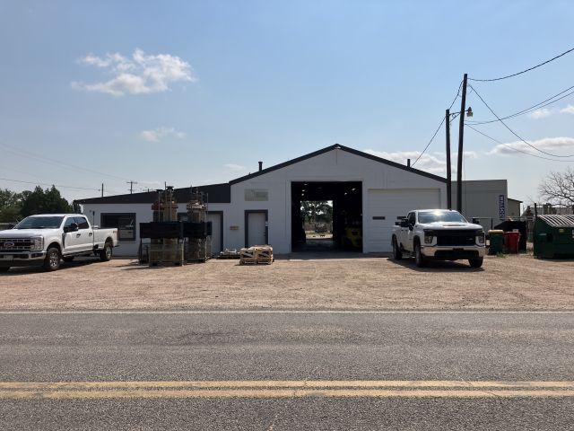
| 1804 CHERRY AVE | WELD | 10 | 05 | 65 |
| Account | Parcel | Account Type | Tax Year | Buildings | Actual Value | Local Govt Assessed Value | School Assessed Value |
|---|---|---|---|---|---|---|---|
| R3360386 | 096110300025 | Commercial | 2026 | 1 | 361,759 | 97,680 | 97,680 |
| Account | Owner Name | Address |
|---|---|---|
| R3360386 | 2020 PAUL AND MELISSA WATSON FAMILY TRUST | 4955 VALLEY OAK DR LOVELAND, CO 805388997 |
| Account | Parcel | Account Type | Tax Year | Buildings | Actual Value | Local Govt Assessed Value | School Assessed Value |
|---|---|---|---|---|---|---|---|
| R3360386 | 096110300025 | Commercial | 2026 | 1 | 361,759 | 97,680 | 97,680 |
| Reception | Rec Date | Type | Grantor | Grantee | Doc Fee | Sale Date | Sale Price |
|---|---|---|---|---|---|---|---|
| 09-25-1962 | COZ | WELD COUNTY ZONING | CASE: Z-23* ZONING C-3 | 0.00 | NA | 0 | |
| 08-31-1990 | SPR | SITE PLAN REVIEW | SPR-148 | 0.00 | NA | 0 | |
| 01669695 | 09-11-1975 | WDN | 0.00 | 01-01-1900 | 0 | ||
| 2221381 | 07-27-1990 | WD | LUTHER CARL A & LUCILLE V | DAVID EDWARD L & SUZANNE | 7.88 | 07-27-1990 | 78,800 |
| 39743 | NA | SUB | SUBDIVISION | UNION COLONY LANDS | 0.00 | NA | 0 |
| 4049189 | 09-26-2014 | QCN | DAVID SUZANNE; DAVID EDWARD L | HOD CHERRY LLC | 0.00 | 09-26-2014 | 0 |
| 5033908 | 06-05-2025 | WD | HOD CHERRY LLC | 2020 PAUL AND MELISSA WATSON FAMILY TRUST | 38.80 | 06-04-2025 | 388,000 |
*If the hyperlink for the reception number does not work, try a manual search in the Clerk and Recorder records. Use the Grantor or Grantee in your search.
| Account | Parcel | Account Type | Tax Year | Buildings | Actual Value | Local Govt Assessed Value | School Assessed Value |
|---|---|---|---|---|---|---|---|
| R3360386 | 096110300025 | Commercial | 2026 | 1 | 361,759 | 97,680 | 97,680 |
Building 1
| AccountNo | Building ID | Occupancy |
|---|---|---|
| R3360386 | 1 | Warehouse |
| ID | Type | NBHD | Occupancy | % Complete | Bedrooms | Baths |
|---|---|---|---|---|---|---|
| 1 | Commercial | 6903 | Warehouse | 100 | 0 | 0.00 |
| ID | Exterior | Roof Cover | Interior | HVAC | Perimeter | Units | Unit Type | Make |
|---|---|---|---|---|---|---|---|---|
| 1 | NA | NA | NA | Package Unit | 314 | 0 | NA | NA |
| ID | Square Ft | Condo SF | Total Basement SF | Finished Basement SF | Garage SF | Carport SF | Balcony SF | Porch SF |
|---|---|---|---|---|---|---|---|---|
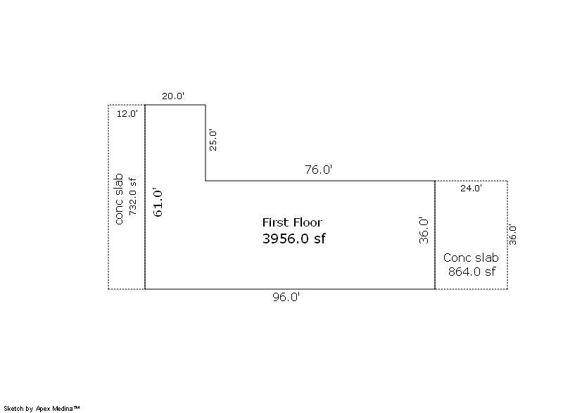
| 1 | 3,956 | 0 | 0 | 0 | 0 | 0 | 0 | 0 |
| ID | Built As | Square Ft | Year Built | Stories | Length | Width |
|---|---|---|---|---|---|---|
| 1.00 | Office Building | 500 | 1958 | 1 | 0 | 0 |
| 1.00 | Storage Warehouse | 3,456 | 1958 | 1 | 0 | 0 |
| ID | Detail Type | Description | Units |
|---|---|---|---|
| 1 | Add On | Chain Link Fence 8ft | 670.00 |
| 1 | Add On | Concrete Slab Average | 1596.00 |
| Account | Parcel | Account Type | Tax Year | Buildings | Actual Value | Local Govt Assessed Value | School Assessed Value |
|---|---|---|---|---|---|---|---|
| R3360386 | 096110300025 | Commercial | 2026 | 1 | 361,759 | 97,680 | 97,680 |
| Type | Code | Description | Actual Value | Local Govt Assessed Value | School Assessed Value | Acres | Land SqFt |
|---|---|---|---|---|---|---|---|
| Improvement | 2220 | OFFICES-IMPROVEMENTS | 64,678 | 17,460 | 17,460 | 0.000 | 0 |
| Improvement | 2235 | WAREHOUSE/STORAGE-IMPS | 115,581 | 31,210 | 31,210 | 0.000 | 0 |
| Land | 2135 | WAREHOUSE/STORAGE-LAND | 181,500 | 49,010 | 49,010 | 0.830 | 36,300 |
| Totals | - | - | 361,759 | 97,680 | 97,680 | 0.830 | 36,300 |
Comparable sales for your Residential or Commercial property may be found using our SALES SEARCH TOOL
Values are updated annually on May 1st for Real Property and June 15th for Personal Property and Oil and Gas.
| Account | Parcel | Account Type | Tax Year | Buildings | Actual Value | Local Govt Assessed Value | School Assessed Value |
|---|---|---|---|---|---|---|---|
| R3360386 | 096110300025 | Commercial | 2026 | 1 | 361,759 | 97,680 | 97,680 |
| Tax Area | District ID | District Name | Local Govt Mill Levy |
School Mill Levy |
Estimated Taxes |
|---|---|---|---|---|---|
| 0685 | 0700 | AIMS JUNIOR COLLEGE | 6.313 | 0.000 | $616.65 |
| 0685 | 1050 | HIGH PLAINS LIBRARY | 3.044 | 0.000 | $297.34 |
| 0685 | 0301 | NORTHERN COLORADO WATER (NCW) | 1.000 | 0.000 | $97.68 |
| 0685 | 0206 | SCHOOL DIST 6-GREELEY | 0.000 | 47.615 | $4,651.03 |
| 0685 | 0100 | WELD COUNTY | 15.956 | 0.000 | $1,558.58 |
| 0685 | 1200 | WEST GREELEY CONSERVATION | 0.414 | 0.000 | $40.44 |
| 0685 | 0519 | WESTERN HILLS FIRE | 10.085 | 0.000 | $985.10 |
| Total | - | - | 36.812 | 47.615 | $8,246.83 |
The estimate of tax is based on the prior year mill levy and the 2025 projected assessment rates. Mill levies and tax estimates will be updated yearly on December 22nd for the current year. Additional information can be found at https://assessor.weld.gov