Account: R3923805
April 5, 2026
| Account | Parcel | Account Type | Tax Year | Buildings | Actual Value | Local Govt Assessed Value | School Assessed Value |
|---|---|---|---|---|---|---|---|
| R3923805 | 080329100001 | Industrial | 2026 | 1 | 758,536 | 204,810 | 204,810 |
| Legal |
|---|
| PT S2NE4 AND PT N2SE4 29-6-65 BEG S4 COR SEC 29 N01D29'W 2605.15' S84D40'E 599.46 TO POB N00D02'W 225.99' S84D40'E 1665.64' S05D19'W 250' N84D40'W 931.42' N01D19'W 25.17' N84D40'W 710.24 TO POB |
| Subdivision | Block | Lot | Land Economic Area |
|---|---|---|---|
| LUCERNE INDUSTRIAL LARGE |
| Property Address | Property City | Section | Township | Range |
|---|---|---|---|---|
| 29 | 06 | 65 |
| Account | Parcel | Account Type | Tax Year | Buildings | Actual Value | Local Govt Assessed Value | School Assessed Value |
|---|---|---|---|---|---|---|---|
| R3923805 | 080329100001 | Industrial | 2026 | 1 | 758,536 | 204,810 | 204,810 |
| Account | Owner Name | Address |
|---|---|---|
| R3923805 | ALTER TRADING CORPORATION | 700 OFFICE PKWY SAINT LOUIS, MO 631417105 |
| Account | Parcel | Account Type | Tax Year | Buildings | Actual Value | Local Govt Assessed Value | School Assessed Value |
|---|---|---|---|---|---|---|---|
| R3923805 | 080329100001 | Industrial | 2026 | 1 | 758,536 | 204,810 | 204,810 |
| Reception | Rec Date | Type | Grantor | Grantee | Doc Fee | Sale Date | Sale Price |
|---|---|---|---|---|---|---|---|
| 02-19-2009 | USR | USE BY SPECIAL REVIEW | USR-1501AM RAILROAD CAR LOADING, SALVAGE | 0.00 | NA | 0 | |
| 1385163 | 07-06-1962 | COZ | WELD COUNTY ZONING | CASE: Z-22 ZONING A | 0.00 | NA | 0 |
| 1385163 | 07-06-1962 | COZ | WELD COUNTY ZONING | CASE: Z-22 ZONING C-3 | 0.00 | NA | 0 |
| 3311587 | 08-10-2005 | QCN | UNION PACIFIC RAILROAD COMPANY | ANDERSEN PROPERTIES LLC | 0.00 | 07-15-2005 | 0 |
| 4737839 | 07-21-2021 | USR | SPR20-0013 | SPR20-0013 | 0.00 | 07-16-2021 | 0 |
| 4974802 | 08-05-2024 | SWD | ANDERSEN PROPERTIES LLC | ALTER TRADING CORPORATION | 198.00 | 08-01-2024 | 1,980,000 |
*If the hyperlink for the reception number does not work, try a manual search in the Clerk and Recorder records. Use the Grantor or Grantee in your search.
| Account | Parcel | Account Type | Tax Year | Buildings | Actual Value | Local Govt Assessed Value | School Assessed Value |
|---|---|---|---|---|---|---|---|
| R3923805 | 080329100001 | Industrial | 2026 | 1 | 758,536 | 204,810 | 204,810 |
Building 1
| AccountNo | Building ID | Occupancy |
|---|---|---|
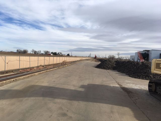
| R3923805 | 1 | Outdoor Storage *Code |
| ID | Type | NBHD | Occupancy | % Complete | Bedrooms | Baths |
|---|---|---|---|---|---|---|
| 1 | Commercial | 6906 | Outdoor Storage *Code | 100 | NA | 0.00 |
| ID | Exterior | Roof Cover | Interior | HVAC | Perimeter | Units | Unit Type | Make |
|---|---|---|---|---|---|---|---|---|
| 1 | NA | NA | NA | NA | NA | 0 | NA | NA |
| ID | Square Ft | Condo SF | Total Basement SF | Finished Basement SF | Garage SF | Carport SF | Balcony SF | Porch SF |
|---|---|---|---|---|---|---|---|---|
| 1 | 1 | 0 | 0 | 0 | 0 | 0 | 0 | 0 |
| ID | Built As | Square Ft | Year Built | Stories | Length | Width |
|---|---|---|---|---|---|---|
| 1.00 | Fenced Lot *Code | 1 | 1990 | 1 | 0 | 0 |
| ID | Detail Type | Description | Units |
|---|---|---|---|
| 1 | Add On | Asphalt Average | 154470.00 |
| 1 | Add On | Chain Link Fence 6Ft. | 2300.00 |
| 1 | Add On | Railroad Spur 80#L.F. | 1280.00 |
| Account | Parcel | Account Type | Tax Year | Buildings | Actual Value | Local Govt Assessed Value | School Assessed Value |
|---|---|---|---|---|---|---|---|
| R3923805 | 080329100001 | Industrial | 2026 | 1 | 758,536 | 204,810 | 204,810 |
| Type | Code | Description | Actual Value | Local Govt Assessed Value | School Assessed Value | Acres | Land SqFt |
|---|---|---|---|---|---|---|---|
| Improvement | 3212 | CONTRACTING/SERVICE-IMPS | 164,987 | 44,550 | 44,550 | 0.000 | 0 |
| Land | 3112 | CONTRACTING/SERVICE-LAND | 593,549 | 160,260 | 160,260 | 9.084 | 395,699 |
| Totals | - | - | 758,536 | 204,810 | 204,810 | 9.084 | 395,699 |
Comparable sales for your Residential or Commercial property may be found using our SALES SEARCH TOOL
Values are updated annually on May 1st for Real Property and June 15th for Personal Property and Oil and Gas.
| Account | Parcel | Account Type | Tax Year | Buildings | Actual Value | Local Govt Assessed Value | School Assessed Value |
|---|---|---|---|---|---|---|---|
| R3923805 | 080329100001 | Industrial | 2026 | 1 | 758,536 | 204,810 | 204,810 |
| Tax Area | District ID | District Name | Local Govt Mill Levy |
School Mill Levy |
Estimated Taxes |
|---|---|---|---|---|---|
| 5055 | 0700 | AIMS JUNIOR COLLEGE | 6.313 | 0.000 | $1,292.97 |
| 5055 | 0911 | EATON AREA PARK AND RECREATION DISTRICT | 5.425 | 0.000 | $1,111.09 |
| 5055 | 0505 | EATON FIRE | 9.000 | 0.000 | $1,843.29 |
| 5055 | 1050 | HIGH PLAINS LIBRARY | 3.044 | 0.000 | $623.44 |
| 5055 | 0304 | NORTH WELD COUNTY WATER (NWC) | 0.000 | 0.000 | $0.00 |
| 5055 | 0301 | NORTHERN COLORADO WATER (NCW) | 1.000 | 0.000 | $204.81 |
| 5055 | 0202 | SCHOOL DIST RE2-EATON | 0.000 | 34.206 | $7,005.73 |
| 5055 | 0100 | WELD COUNTY | 15.956 | 0.000 | $3,267.95 |
| 5055 | 1200 | WEST GREELEY CONSERVATION | 0.414 | 0.000 | $84.79 |
| Total | - | - | 41.152 | 34.206 | $15,434.07 |
The estimate of tax is based on the prior year mill levy and the 2025 projected assessment rates. Mill levies and tax estimates will be updated yearly on December 22nd for the current year. Additional information can be found at https://assessor.weld.gov