Account: R5227008
April 1, 2026
| Account | Parcel | Account Type | Tax Year | Buildings | Actual Value | Local Govt Assessed Value | School Assessed Value |
|---|---|---|---|---|---|---|---|
| R5227008 | 096318300010 | Agricultural | 2026 | 1 | 407,625 | 110,070 | 110,060 |
| Legal |
|---|
| PT NE4SW4 18 5 64 LOT B REC EXEMPT RE-4739 |
| Subdivision | Block | Lot | Land Economic Area |
|---|---|---|---|
| KERSEY RURAL |
| Property Address | Property City | Section | Township | Range |
|---|---|---|---|---|
| 27269 COUNTY ROAD 49 1/2 | WELD | 18 | 05 | 64 |
| Account | Parcel | Account Type | Tax Year | Buildings | Actual Value | Local Govt Assessed Value | School Assessed Value |
|---|---|---|---|---|---|---|---|
| R5227008 | 096318300010 | Agricultural | 2026 | 1 | 407,625 | 110,070 | 110,060 |
| Account | Owner Name | Address |
|---|---|---|
| R5227008 | 27269 CR 49.5 LLC | 220 BLUEGRASS ST EATON, CO 806158219 |
| Account | Parcel | Account Type | Tax Year | Buildings | Actual Value | Local Govt Assessed Value | School Assessed Value |
|---|---|---|---|---|---|---|---|
| R5227008 | 096318300010 | Agricultural | 2026 | 1 | 407,625 | 110,070 | 110,060 |
| Reception | Rec Date | Type | Grantor | Grantee | Doc Fee | Sale Date | Sale Price |
|---|---|---|---|---|---|---|---|
| 3530584 | 01-23-2008 | RE | RECORDED EXEMPTION | RE-4739 | 0.00 | NA | 0 |
| 3530584 | 01-23-2008 | RE | RE-4739 | RE-4739 | 0.00 | 01-23-2008 | 0 |
| 3541516 | 03-13-2008 | SWD | LATHAM LAND LLC | RAM LAND CO LLC | 7.50 | 03-13-2008 | 75,000 |
| 3576469 | 09-04-2008 | QCN | RAM LAND CO LLC | RAM LAND CO LLC | 0.00 | 09-04-2008 | 0 |
| 3696177 | 05-28-2010 | SWD | RAM LAND CO LLC | SHARP DARREN | 14.25 | 05-25-2010 | 142,500 |
| 4853684 | 09-07-2022 | USR | SURVEY | SURVEY | 0.00 | 12-27-2021 | 0 |
| 4884649 | 03-03-2023 | QCN | SHARP DARREN | SHARP TARYN | 0.00 | 02-28-2023 | 0 |
| 4888712 | 03-27-2023 | QCN | SHARP TARYN | T & BKS22 LLC | 0.00 | 03-27-2023 | 0 |
| 5050313 | 08-29-2025 | QCN | T & BKS22 LLC | 27269 CR 49.5 LLC | 0.00 | 08-29-2025 | 0 |
*If the hyperlink for the reception number does not work, try a manual search in the Clerk and Recorder records. Use the Grantor or Grantee in your search.
| Account | Parcel | Account Type | Tax Year | Buildings | Actual Value | Local Govt Assessed Value | School Assessed Value |
|---|---|---|---|---|---|---|---|
| R5227008 | 096318300010 | Agricultural | 2026 | 1 | 407,625 | 110,070 | 110,060 |
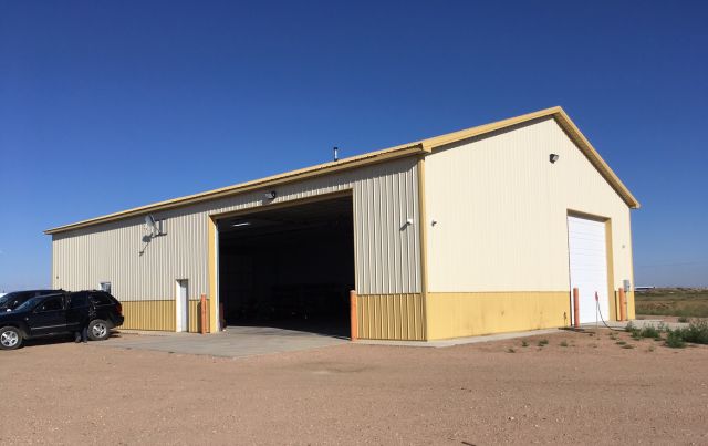
Building 1
| AccountNo | Building ID | Occupancy |
|---|---|---|
| R5227008 | 1 | Warehouse |
| ID | Type | NBHD | Occupancy | % Complete | Bedrooms | Baths |
|---|---|---|---|---|---|---|
| 1 | Commercial | 6901 | Warehouse | 100 | NA | 0.00 |
| ID | Exterior | Roof Cover | Interior | HVAC | Perimeter | Units | Unit Type | Make |
|---|---|---|---|---|---|---|---|---|
| 1 | NA | NA | NA | Electric | 260 | 0 | NA | NA |
| ID | Square Ft | Condo SF | Total Basement SF | Finished Basement SF | Garage SF | Carport SF | Balcony SF | Porch SF |
|---|---|---|---|---|---|---|---|---|
| 1 | 4,000 | 0 | 0 | 0 | 0 | 0 | 0 | 0 |
| ID | Built As | Square Ft | Year Built | Stories | Length | Width |
|---|---|---|---|---|---|---|
| 1.00 | Equipment Building-Commercial | 4,000 | 2014 | 1 | 80 | 50 |
| ID | Detail Type | Description | Units |
|---|---|---|---|
| 1 | Add On | Concrete Slab Average | 1218.00 |
| 1 | Add On | Metal Panel Fence 8 ft | 470.00 |
| Account | Parcel | Account Type | Tax Year | Buildings | Actual Value | Local Govt Assessed Value | School Assessed Value |
|---|---|---|---|---|---|---|---|
| R5227008 | 096318300010 | Agricultural | 2026 | 1 | 407,625 | 110,070 | 110,060 |
| Type | Code | Description | Actual Value | Local Govt Assessed Value | School Assessed Value | Acres | Land SqFt |
|---|---|---|---|---|---|---|---|
| Improvement | 2235 | WAREHOUSE/STORAGE-IMPS | 373,500 | 100,850 | 100,850 | 0.000 | 0 |
| Land | 2135 | WAREHOUSE/STORAGE-LAND | 11,569 | 3,120 | 3,120 | 1.000 | 43,560 |
| Land | 4117 | FLOOD IRRIGATED LAND-AGRICULTURAL | 22,539 | 6,090 | 6,090 | 23.358 | 1,017,474 |
| Land | 4167 | WASTE LAND | 17 | 10 | 0 | 2.610 | 113,692 |
| Totals | - | - | 407,625 | 110,070 | 110,060 | 26.968 | 1,174,726 |
Comparable sales for your Residential or Commercial property may be found using our SALES SEARCH TOOL
Values are updated annually on May 1st for Real Property and June 15th for Personal Property and Oil and Gas.
| Account | Parcel | Account Type | Tax Year | Buildings | Actual Value | Local Govt Assessed Value | School Assessed Value |
|---|---|---|---|---|---|---|---|
| R5227008 | 096318300010 | Agricultural | 2026 | 1 | 407,625 | 110,070 | 110,060 |
| Tax Area | District ID | District Name | Local Govt Mill Levy |
School Mill Levy |
Estimated Taxes |
|---|---|---|---|---|---|
| 0738 | 0700 | AIMS JUNIOR COLLEGE | 6.313 | 0.000 | $694.87 |
| 0738 | 0302 | CENTRAL COLORADO WATER (CCW) | 0.980 | 0.000 | $107.87 |
| 0738 | 0309 | CENTRAL COLORADO WATER SUBDISTRICT (CCS) | 1.462 | 0.000 | $160.92 |
| 0738 | 0305 | CENTRAL WELD COUNTY WATER (CWC) | 0.000 | 0.000 | $0.00 |
| 0738 | 1050 | HIGH PLAINS LIBRARY | 3.044 | 0.000 | $335.05 |
| 0738 | 0301 | NORTHERN COLORADO WATER (NCW) | 1.000 | 0.000 | $110.07 |
| 0738 | 0515 | PLATTE VALLEY FIRE | 5.165 | 0.000 | $568.51 |
| 0738 | 0207 | SCHOOL DIST RE7-KERSEY | 0.000 | 11.014 | $1,212.20 |
| 0738 | 0100 | WELD COUNTY | 15.956 | 0.000 | $1,756.28 |
| 0738 | 1200 | WEST GREELEY CONSERVATION | 0.414 | 0.000 | $45.57 |
| Total | - | - | 34.334 | 11.014 | $4,991.34 |
The estimate of tax is based on the prior year mill levy and the 2025 projected assessment rates. Mill levies and tax estimates will be updated yearly on December 22nd for the current year. Additional information can be found at https://assessor.weld.gov