Account: R5416386
April 1, 2026
| Account | Parcel | Account Type | Tax Year | Buildings | Actual Value | Local Govt Assessed Value | School Assessed Value |
|---|---|---|---|---|---|---|---|
| R5416386 | 131121000003 | Agricultural | 2026 | 1 | 107,564 | 8,180 | 8,980 |
| Legal |
|---|
| 20373 N2 21 2 67 EXC OG&M (11L) EXC MINERALS |
| Subdivision | Block | Lot | Land Economic Area |
|---|---|---|---|
| SW ECON 4 RURAL |
| Property Address | Property City | Section | Township | Range |
|---|---|---|---|---|
| 8016 COUNTY ROAD 20 | WELD | 21 | 02 | 67 |
| Account | Parcel | Account Type | Tax Year | Buildings | Actual Value | Local Govt Assessed Value | School Assessed Value |
|---|---|---|---|---|---|---|---|
| R5416386 | 131121000003 | Agricultural | 2026 | 1 | 107,564 | 8,180 | 8,980 |
| Account | Owner Name | Address |
|---|---|---|
| R5416386 | ANADARKO E&P ONSHORE LLC | ATTN: STEVE FISHER LAND SURFACE ROCKIES 1099 18TH ST DENVER, CO 802021908 |
| Account | Parcel | Account Type | Tax Year | Buildings | Actual Value | Local Govt Assessed Value | School Assessed Value |
|---|---|---|---|---|---|---|---|
| R5416386 | 131121000003 | Agricultural | 2026 | 1 | 107,564 | 8,180 | 8,980 |
| Reception | Rec Date | Type | Grantor | Grantee | Doc Fee | Sale Date | Sale Price |
|---|---|---|---|---|---|---|---|
| 02118307 | 10-20-1987 | OTH | 0.00 | 01-01-1900 | 0 | ||
| 3783408 | 08-01-2011 | SWD | STREAR FARMS COMPANY | BB COLORADO HOLDINGS LLC | 612.67 | 07-29-2011 | 6,126,700 |
| 3966755 | 09-27-2013 | SWDN | BB COLORADO HOLDINGS LLC | BB COLORADO HOLDINGS LLC | 0.00 | 09-25-2013 | 0 |
| 4308480 | 06-07-2017 | SWD | BB COLORADO HOLDINGS LLC | DENMORE LLC | 202.23 | 06-05-2017 | 2,022,300 |
| 4310585 | 06-15-2017 | SURV | SURVEY | SURVEY | 0.00 | 06-15-2017 | 0 |
| 4316899 | 07-11-2017 | SWD | DENMORE LLC | DLS LAND COMPANY LLC | 616.50 | 06-20-2017 | 6,165,000 |
| 4345921 | 10-20-2017 | SWDN | DLS LAND COMPANY LLC | ANADARKO E&P ONSHORE LLC | 0.00 | 10-19-2017 | 0 |
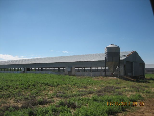
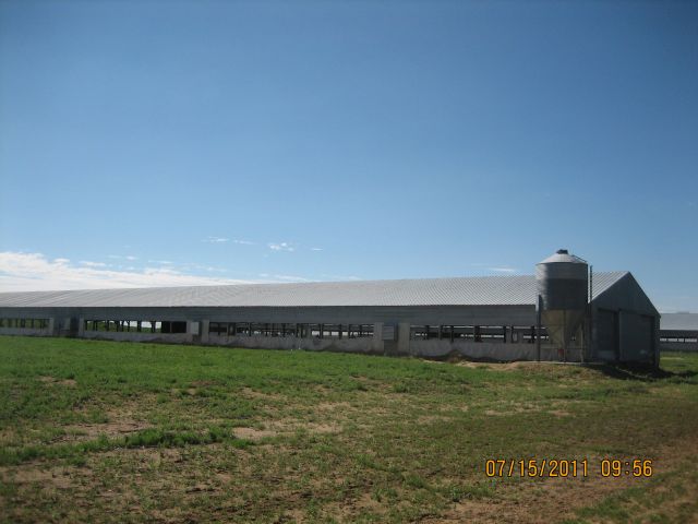
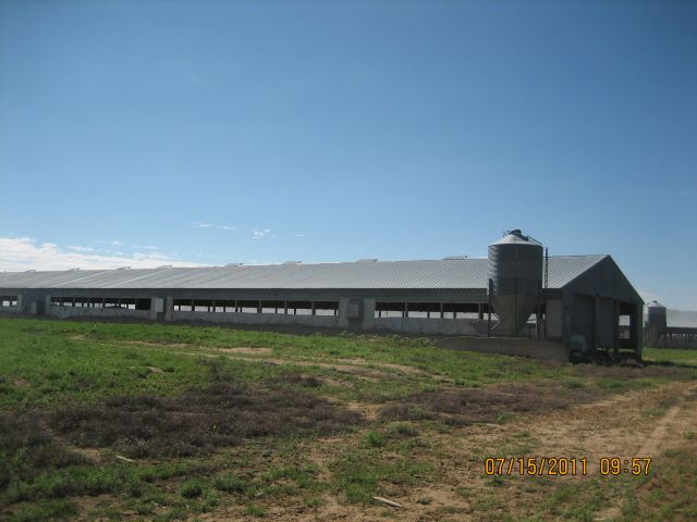
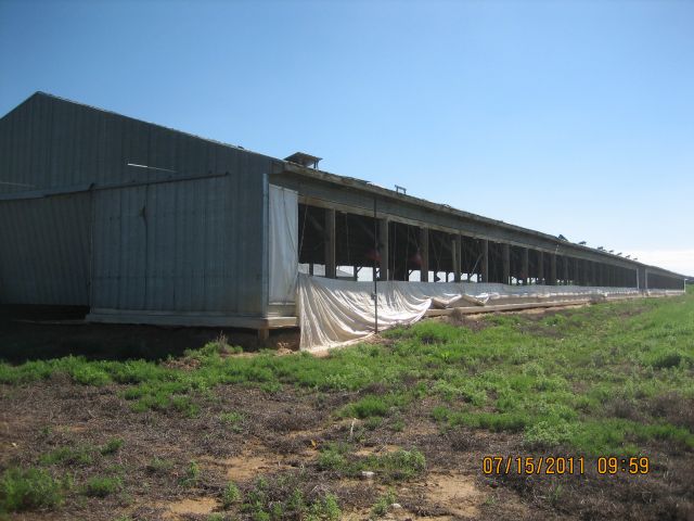
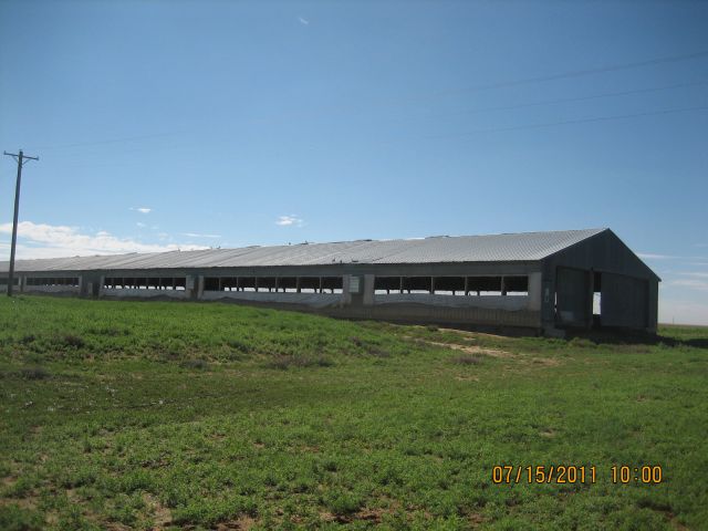
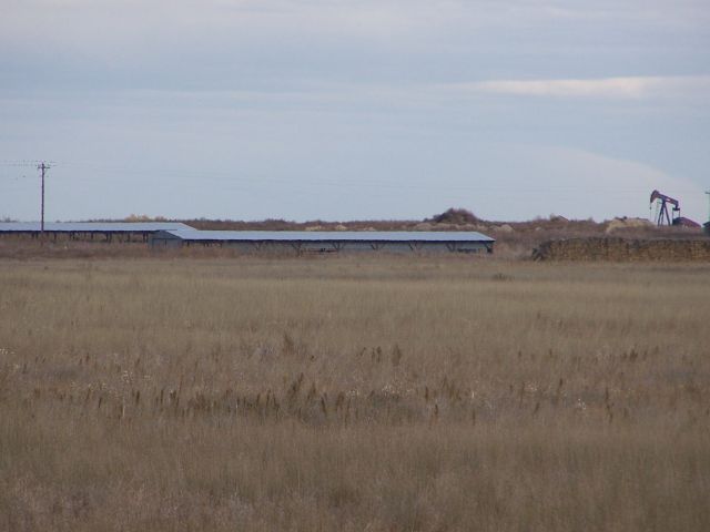
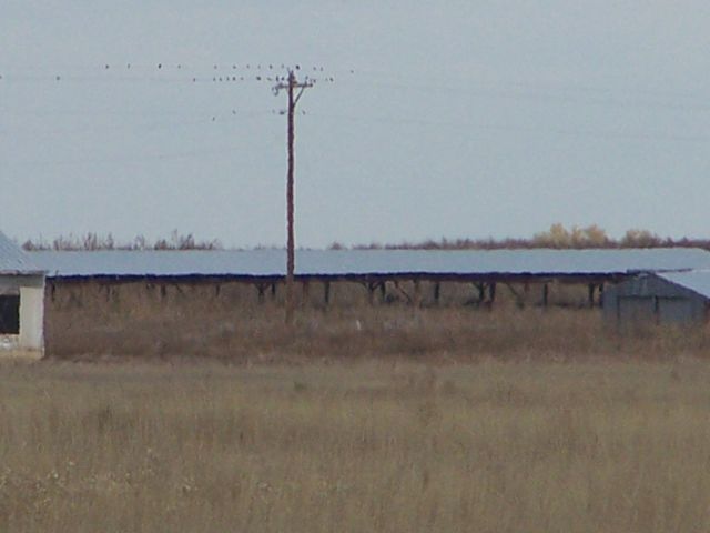
| 710345COMM | 11-12-1971 | USR | USE BY SPECIAL REVIEW | SUP-118 TURKEY FARM 70,000 | 0.00 | NA | 0 |
*If the hyperlink for the reception number does not work, try a manual search in the Clerk and Recorder records. Use the Grantor or Grantee in your search.
| Account | Parcel | Account Type | Tax Year | Buildings | Actual Value | Local Govt Assessed Value | School Assessed Value |
|---|---|---|---|---|---|---|---|
| R5416386 | 131121000003 | Agricultural | 2026 | 1 | 107,564 | 8,180 | 8,980 |
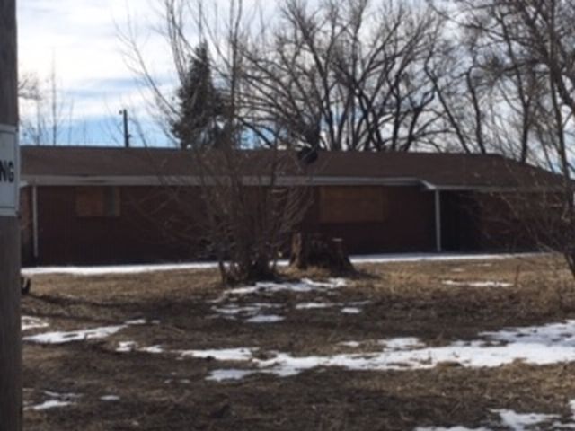
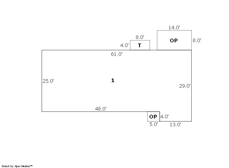
Building 1
| AccountNo | Building ID | Occupancy |
|---|---|---|
| R5416386 | 1 | Single Family Residential on Ag |
| ID | Type | NBHD | Occupancy | % Complete | Bedrooms | Baths |
|---|---|---|---|---|---|---|
| 1 | Residential | 4R0011 | Single Family Residential on Ag | 100 | 3 | 2.00 |
| ID | Exterior | Roof Cover | Interior | HVAC | Perimeter | Units | Unit Type | Make |
|---|---|---|---|---|---|---|---|---|
| 1 | Frame Masonry Veneer | Composition Shingle | Drywall | Forced Air | 0 | 0 | NA | NA |
| ID | Square Ft | Condo SF | Total Basement SF | Finished Basement SF | Garage SF | Carport SF | Balcony SF | Porch SF |
|---|---|---|---|---|---|---|---|---|
| 1 | 1,577 | 0 | 0 | 0 | 0 | 0 | 0 | 0 |
| ID | Built As | Square Ft | Year Built | Stories | Length | Width |
|---|---|---|---|---|---|---|
| 1.00 | Ranch 1 Story | 1,577 | 1967 | 1 | 0 | 0 |
No Additional Details for Building 1
| Account | Parcel | Account Type | Tax Year | Buildings | Actual Value | Local Govt Assessed Value | School Assessed Value |
|---|---|---|---|---|---|---|---|
| R5416386 | 131121000003 | Agricultural | 2026 | 1 | 107,564 | 8,180 | 8,980 |
| Type | Code | Description | Actual Value | Local Govt Assessed Value | School Assessed Value | Acres | Land SqFt |
|---|---|---|---|---|---|---|---|
| Improvement | 4277 | FARM/RANCH RESIDENCE-IMPS | 100,589 | 6,290 | 7,090 | 0.000 | 0 |
| Land | 4147 | GRAZING LAND-AGRICULTURAL | 6,803 | 1,840 | 1,840 | 291.000 | 12,675,960 |
| Land | 4167 | WASTE LAND | 172 | 50 | 50 | 30.000 | 1,306,800 |
| Totals | - | - | 107,564 | 8,180 | 8,980 | 321.000 | 13,982,760 |
Comparable sales for your Residential or Commercial property may be found using our SALES SEARCH TOOL
Values are updated annually on May 1st for Real Property and June 15th for Personal Property and Oil and Gas.
| Account | Parcel | Account Type | Tax Year | Buildings | Actual Value | Local Govt Assessed Value | School Assessed Value |
|---|---|---|---|---|---|---|---|
| R5416386 | 131121000003 | Agricultural | 2026 | 1 | 107,564 | 8,180 | 8,980 |
| Tax Area | District ID | District Name | Local Govt Mill Levy |
School Mill Levy |
Estimated Taxes |
|---|---|---|---|---|---|
| 2281 | 0700 | AIMS JUNIOR COLLEGE | 6.313 | 0.000 | $51.64 |
| 2281 | 0305 | CENTRAL WELD COUNTY WATER (CWC) | 0.000 | 0.000 | $0.00 |
| 2281 | 0506 | FORT LUPTON FIRE | 9.357 | 0.000 | $76.54 |
| 2281 | 1050 | HIGH PLAINS LIBRARY | 3.044 | 0.000 | $24.90 |
| 2281 | 1202 | LONGMONT CONSERVATION | 0.000 | 0.000 | $0.00 |
| 2281 | 0301 | NORTHERN COLORADO WATER (NCW) | 1.000 | 0.000 | $8.18 |
| 2281 | 0208 | SCHOOL DIST RE8-FORT LUPTON AND DACONO | 0.000 | 18.198 | $163.42 |
| 2281 | 0100 | WELD COUNTY | 15.956 | 0.000 | $130.52 |
| Total | - | - | 35.67 | 18.198 | $455.20 |
The estimate of tax is based on the prior year mill levy and the 2025 projected assessment rates. Mill levies and tax estimates will be updated yearly on December 22nd for the current year. Additional information can be found at https://assessor.weld.gov