Account: R5424586
April 1, 2026
| Account | Parcel | Account Type | Tax Year | Buildings | Actual Value | Local Govt Assessed Value | School Assessed Value |
|---|---|---|---|---|---|---|---|
| R5424586 | 131124003002 | Residential | 2026 | 2 | 628,391 | 39,280 | 44,300 |
| Legal |
|---|
| LML-9 L9 A REPLAT OF LOTS 8-9-10 LUPTON MEADOWS LAND CO DIV 3 PT NE4 24-2-67 (.55R .66D) |
| Subdivision | Block | Lot | Land Economic Area |
|---|---|---|---|
| LUPTON MEADOWS LAND CO DIV #3 RPLT L8-10 | 9 | FORT LUPTON RURAL |
| Property Address | Property City | Section | Township | Range |
|---|---|---|---|---|
| 8721 COUNTY ROAD 25 | WELD | 24 | 02 | 67 |
| Account | Parcel | Account Type | Tax Year | Buildings | Actual Value | Local Govt Assessed Value | School Assessed Value |
|---|---|---|---|---|---|---|---|
| R5424586 | 131124003002 | Residential | 2026 | 2 | 628,391 | 39,280 | 44,300 |
| Account | Owner Name | Address |
|---|---|---|
| R5424586 | CURBY KENNETH E | 8721 COUNTY ROAD 25 FORT LUPTON, CO 806219305 |
| R5424586 | BJERKE STACY A |
| Account | Parcel | Account Type | Tax Year | Buildings | Actual Value | Local Govt Assessed Value | School Assessed Value |
|---|---|---|---|---|---|---|---|
| R5424586 | 131124003002 | Residential | 2026 | 2 | 628,391 | 39,280 | 44,300 |
| Reception | Rec Date | Type | Grantor | Grantee | Doc Fee | Sale Date | Sale Price |
|---|---|---|---|---|---|---|---|
| 01879198 | 01-07-1982 | PLT | 0.00 | 01-01-1900 | 0 | ||
| 02100583 | 05-21-1987 | QCN | 0.00 | 03-09-1987 | 0 | ||
| 02181905 | 06-07-1989 | QCN | 0.00 | 06-02-1989 | 0 | ||
| 1879198 | NA | SUB | SUBDIVISION | LUPTON MEADOWS DIVISION #3 RPLT LOTS 8-10 | 0.00 | NA | 0 |
| 2783390 | 07-28-2000 | WD | GEE WILLIAM E TRUST | SCHROEDER TODD M & GINGER | 23.50 | 07-26-2000 | 235,000 |
| 2790083 | 08-29-2000 | QCN | SCHROEDER TODD M & GINGER | SCHROEDER TODD M & G AUDREY | 0.00 | 07-26-2000 | 0 |
| 3139055 | 12-24-2003 | WD | SCHROEDER TODD M & G AUDREY | CURBY KENNETH E & | 31.50 | 12-19-2003 | 315,000 |
*If the hyperlink for the reception number does not work, try a manual search in the Clerk and Recorder records. Use the Grantor or Grantee in your search.
| Account | Parcel | Account Type | Tax Year | Buildings | Actual Value | Local Govt Assessed Value | School Assessed Value |
|---|---|---|---|---|---|---|---|
| R5424586 | 131124003002 | Residential | 2026 | 2 | 628,391 | 39,280 | 44,300 |
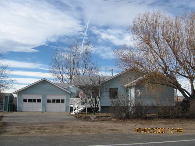
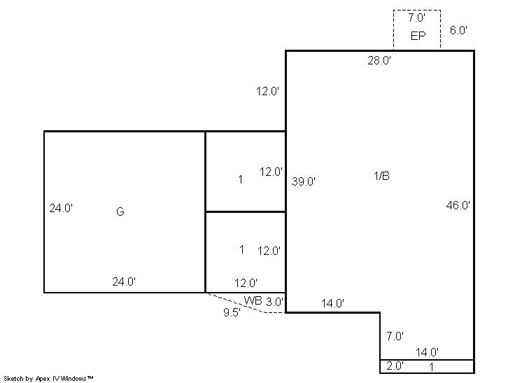
Building 1
| AccountNo | Building ID | Occupancy |
|---|---|---|
| R5424586 | 1 | Single Family Residential |
| ID | Type | NBHD | Occupancy | % Complete | Bedrooms | Baths |
|---|---|---|---|---|---|---|
| 1 | Residential | 4R0009 | Single Family Residential | 100 | 2 | 3.00 |
| ID | Exterior | Roof Cover | Interior | HVAC | Perimeter | Units | Unit Type | Make |
|---|---|---|---|---|---|---|---|---|
| 1 | Frame Siding | Composition Shingle | Drywall | Forced Air | 0 | 0 | NA | NA |
| ID | Square Ft | Condo SF | Total Basement SF | Finished Basement SF | Garage SF | Carport SF | Balcony SF | Porch SF |
|---|---|---|---|---|---|---|---|---|
| 1 | 1,534 | 0 | 1,190 | 0 | 576 | 0 | 22 | 42 |
| ID | Built As | Square Ft | Year Built | Stories | Length | Width |
|---|---|---|---|---|---|---|
| 1.00 | Ranch 1 Story | 1,534 | 1920 | 1 | 0 | 0 |
| ID | Detail Type | Description | Units |
|---|---|---|---|
| 1 | Balcony | Wood Wood Fin | 22.00 |
| 1 | Basement | Total Basement SF | 1190.00 |
| 1 | Fixture | Full Bath | 3.00 |
| 1 | Garage | Attached | 576.00 |
| 1 | Porch | Encl Solid Wall | 42.00 |
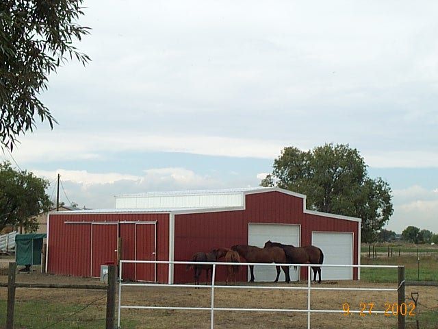
Building 2
| AccountNo | Building ID | Occupancy |
|---|---|---|
| R5424586 | 2 | Utility Building |
| ID | Type | NBHD | Occupancy | % Complete | Bedrooms | Baths |
|---|---|---|---|---|---|---|
| 2 | Out Building | NA | Utility Building | 100 | 0 | 0.00 |
| ID | Exterior | Roof Cover | Interior | HVAC | Perimeter | Units | Unit Type | Make |
|---|---|---|---|---|---|---|---|---|
| 2 | NA | NA | NA | None | 132 | 0 | NA | NA |
| ID | Square Ft | Condo SF | Total Basement SF | Finished Basement SF | Garage SF | Carport SF | Balcony SF | Porch SF |
|---|---|---|---|---|---|---|---|---|
| 2 | 1,080 | 0 | 0 | 0 | 0 | 0 | 0 | 0 |
| ID | Built As | Square Ft | Year Built | Stories | Length | Width |
|---|---|---|---|---|---|---|
| 2.00 | Utility Building | 1,080 | 2000 | 1 | 36 | 30 |
No Additional Details for Building 2
| Account | Parcel | Account Type | Tax Year | Buildings | Actual Value | Local Govt Assessed Value | School Assessed Value |
|---|---|---|---|---|---|---|---|
| R5424586 | 131124003002 | Residential | 2026 | 2 | 628,391 | 39,280 | 44,300 |
| Type | Code | Description | Actual Value | Local Govt Assessed Value | School Assessed Value | Acres | Land SqFt |
|---|---|---|---|---|---|---|---|
| Improvement | 1212 | SINGLE FAMILY RESIDENTIAL IMPROVEMENTS | 427,612 | 26,730 | 30,150 | 0.000 | 0 |
| Land | 1112 | SINGLE FAMILY RESIDENTIAL-LAND | 200,779 | 12,550 | 14,150 | 4.010 | 174,676 |
| Totals | - | - | 628,391 | 39,280 | 44,300 | 4.010 | 174,676 |
Comparable sales for your Residential or Commercial property may be found using our SALES SEARCH TOOL
Values are updated annually on May 1st for Real Property and June 15th for Personal Property and Oil and Gas.
| Account | Parcel | Account Type | Tax Year | Buildings | Actual Value | Local Govt Assessed Value | School Assessed Value |
|---|---|---|---|---|---|---|---|
| R5424586 | 131124003002 | Residential | 2026 | 2 | 628,391 | 39,280 | 44,300 |
| Tax Area | District ID | District Name | Local Govt Mill Levy |
School Mill Levy |
Estimated Taxes |
|---|---|---|---|---|---|
| 2228 | 0700 | AIMS JUNIOR COLLEGE | 6.313 | 0.000 | $247.97 |
| 2228 | 0302 | CENTRAL COLORADO WATER (CCW) | 0.980 | 0.000 | $38.49 |
| 2228 | 0309 | CENTRAL COLORADO WATER SUBDISTRICT (CCS) | 1.462 | 0.000 | $57.43 |
| 2228 | 0506 | FORT LUPTON FIRE | 9.357 | 0.000 | $367.54 |
| 2228 | 1050 | HIGH PLAINS LIBRARY | 3.044 | 0.000 | $119.57 |
| 2228 | 0301 | NORTHERN COLORADO WATER (NCW) | 1.000 | 0.000 | $39.28 |
| 2228 | 1201 | PLATTE VALLEY CONSERVATION | 0.000 | 0.000 | $0.00 |
| 2228 | 0208 | SCHOOL DIST RE8-FORT LUPTON AND DACONO | 0.000 | 18.198 | $806.17 |
| 2228 | 0100 | WELD COUNTY | 15.956 | 0.000 | $626.75 |
| Total | - | - | 38.112 | 18.198 | $2,303.21 |
The estimate of tax is based on the prior year mill levy and the 2025 projected assessment rates. Mill levies and tax estimates will be updated yearly on December 22nd for the current year. Additional information can be found at https://assessor.weld.gov