Account: R6776749
April 2, 2026
| Account | Parcel | Account Type | Tax Year | Buildings | Actual Value | Local Govt Assessed Value | School Assessed Value |
|---|---|---|---|---|---|---|---|
| R6776749 | 147120300007 | Agricultural | 2026 | 379,127 | 24,110 | 27,130 |
| Legal |
|---|
| PT N2SW4 20-1-66 EXC THAT PT LYING EAST OF UNION PACIFIC RR |
| Subdivision | Block | Lot | Land Economic Area |
|---|---|---|---|
| FORT LUPTON RURAL |
| Property Address | Property City | Section | Township | Range |
|---|---|---|---|---|
| 2292 COUNTY ROAD 27 | WELD | 20 | 01 | 66 |
| Account | Parcel | Account Type | Tax Year | Buildings | Actual Value | Local Govt Assessed Value | School Assessed Value |
|---|---|---|---|---|---|---|---|
| R6776749 | 147120300007 | Agricultural | 2026 | 379,127 | 24,110 | 27,130 |
| Account | Owner Name | Address |
|---|---|---|
| R6776749 | ANADARKO E&P ONSHORE LLC | ATTN: STEVE FISHER LAND SURFACE ROCKIES 1099 18TH ST DENVER, CO 802021908 |
| Account | Parcel | Account Type | Tax Year | Buildings | Actual Value | Local Govt Assessed Value | School Assessed Value |
|---|---|---|---|---|---|---|---|
| R6776749 | 147120300007 | Agricultural | 2026 | 379,127 | 24,110 | 27,130 |
| Reception | Rec Date | Type | Grantor | Grantee | Doc Fee | Sale Date | Sale Price |
|---|---|---|---|---|---|---|---|
| 3289105 | 05-25-2005 | COZ | WELD COUNTY ZONING | CASE: CZ-1052 ZONING I-3 | 0.00 | NA | 0 |
| 4071118 | 12-24-2014 | SPR | SITE PLAN REVIEW | SPR-14-0005 | 0.00 | NA | 0 |
| 5001641 | 12-23-2024 | SURV | SURVEY | SURVEY | 0.00 | 11-27-2024 | 0 |
| 5009252 | 02-03-2025 | WD | HUNT BROTHERS PROPERTIES INC | ANADARKO E&P ONSHORE LLC | 322.13 | 01-28-2025 | 3,221,300 |
*If the hyperlink for the reception number does not work, try a manual search in the Clerk and Recorder records. Use the Grantor or Grantee in your search.
| Account | Parcel | Account Type | Tax Year | Buildings | Actual Value | Local Govt Assessed Value | School Assessed Value |
|---|---|---|---|---|---|---|---|
| R6776749 | 147120300007 | Agricultural | 2026 | 379,127 | 24,110 | 27,130 |
No buildings found.
| Account | Parcel | Account Type | Tax Year | Buildings | Actual Value | Local Govt Assessed Value | School Assessed Value |
|---|---|---|---|---|---|---|---|
| R6776749 | 147120300007 | Agricultural | 2026 | 379,127 | 24,110 | 27,130 |
| Type | Code | Description | Actual Value | Local Govt Assessed Value | School Assessed Value | Acres | Land SqFt |
|---|---|---|---|---|---|---|---|
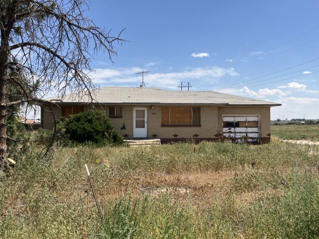
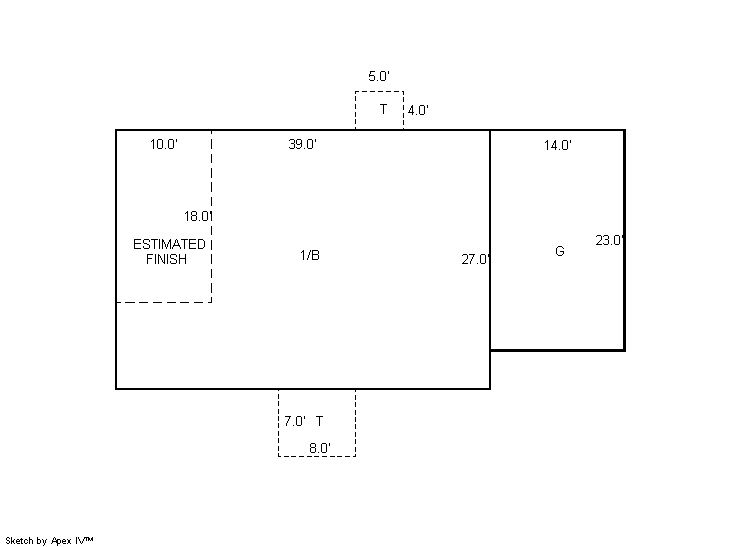
| Improvement | 4277 | FARM/RANCH RESIDENCE-IMPS | 377,127 | 23,570 | 26,590 | 0.000 | 0 |
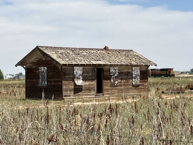
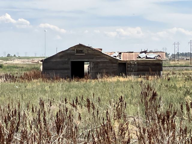
| Improvement | 4279 | FARM RANCH SUPPORT BLDGS | 700 | 190 | 190 | 0.000 | 0 |
| Land | 4127 | DRY FARM LAND-AGRICULTURAL | 1,300 | 350 | 350 | 15.227 | 663,288 |
| Totals | - | - | 379,127 | 24,110 | 27,130 | 15.227 | 663,288 |
Comparable sales for your Residential or Commercial property may be found using our SALES SEARCH TOOL
Values are updated annually on May 1st for Real Property and June 15th for Personal Property and Oil and Gas.
| Account | Parcel | Account Type | Tax Year | Buildings | Actual Value | Local Govt Assessed Value | School Assessed Value |
|---|---|---|---|---|---|---|---|
| R6776749 | 147120300007 | Agricultural | 2026 | 379,127 | 24,110 | 27,130 |
| Tax Area | District ID | District Name | Local Govt Mill Levy |
School Mill Levy |
Estimated Taxes |
|---|---|---|---|---|---|
| 2501 | 0700 | AIMS JUNIOR COLLEGE | 6.313 | 0.000 | $152.21 |
| 2501 | 0302 | CENTRAL COLORADO WATER (CCW) | 0.980 | 0.000 | $23.63 |
| 2501 | 0309 | CENTRAL COLORADO WATER SUBDISTRICT (CCS) | 1.462 | 0.000 | $35.25 |
| 2501 | 0506 | FORT LUPTON FIRE | 9.357 | 0.000 | $225.60 |
| 2501 | 1050 | HIGH PLAINS LIBRARY | 3.044 | 0.000 | $73.39 |
| 2501 | 0208 | SCHOOL DIST RE8-FORT LUPTON AND DACONO | 0.000 | 18.198 | $493.71 |
| 2501 | 0100 | WELD COUNTY | 15.956 | 0.000 | $384.70 |
| 2501 | 1209 | WEST ADAMS CONSERVATION | 0.000 | 0.000 | $0.00 |
| Total | - | - | 37.112 | 18.198 | $1,388.48 |
The estimate of tax is based on the prior year mill levy and the 2025 projected assessment rates. Mill levies and tax estimates will be updated yearly on December 22nd for the current year. Additional information can be found at https://assessor.weld.gov