Account: R6778966
April 1, 2026
| Account | Parcel | Account Type | Tax Year | Buildings | Actual Value | Local Govt Assessed Value | School Assessed Value |
|---|---|---|---|---|---|---|---|
| R6778966 | 146923400026 | Agricultural | 2026 | 125,903 | 33,990 | 33,990 |
| Legal |
|---|
| SE4 23-1-67 ALSO STRIP OF LAND 25' WIDE IN NE4 DESC IN BK1401 PGE84 REC 1189682 EXC COMM SE COR M00D39W 1986 TO POB S89D20W 47.13 N37D04W 54.42 N60D28W 203.24 N41D58W 118.61 N21D54W 141.57 N27D45W 96.38 N21D57W 58.47 N29D55W 84.89 N52D07W 65.52 N88D44W 89.89 N00D22W 23.81 N89D37E 632.32 S00D39E 645.73 TO POB |
| Subdivision | Block | Lot | Land Economic Area |
|---|---|---|---|
| FORT LUPTON RURAL |
| Property Address | Property City | Section | Township | Range |
|---|---|---|---|---|
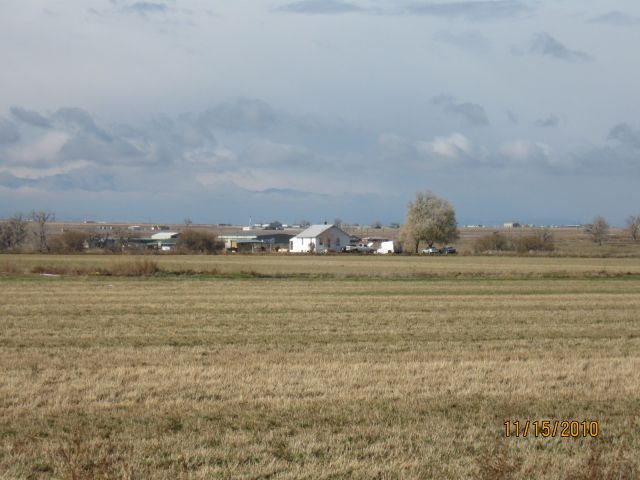
| 2153 COUNTY ROAD 23 | WELD | 23 | 01 | 67 |
| Account | Parcel | Account Type | Tax Year | Buildings | Actual Value | Local Govt Assessed Value | School Assessed Value |
|---|---|---|---|---|---|---|---|
| R6778966 | 146923400026 | Agricultural | 2026 | 125,903 | 33,990 | 33,990 |
| Account | Owner Name | Address |
|---|---|---|
| R6778966 | ANADARKO E&P ONSHORE LLC | ATTN: STEVE FISHER LAND SURFACE ROCKIES 1099 18TH ST DENVER, CO 802021908 |
| Account | Parcel | Account Type | Tax Year | Buildings | Actual Value | Local Govt Assessed Value | School Assessed Value |
|---|---|---|---|---|---|---|---|
| R6778966 | 146923400026 | Agricultural | 2026 | 125,903 | 33,990 | 33,990 |
| Reception | Rec Date | Type | Grantor | Grantee | Doc Fee | Sale Date | Sale Price |
|---|---|---|---|---|---|---|---|
| 3865445 | 08-13-2012 | SURV | SURVEY | SURVEY | 0.00 | 08-13-2012 | 0 |
| 3875943 | 09-25-2012 | QCN | KIRKMEYER BARBARA J | ZEHNDER STEPHEN A | 0.00 | 09-21-2012 | 0 |
| 3957497 | 08-19-2013 | SWD | ZEHNDER STEPHEN A | WELD P205 LAND HOLDINGS LLC | 270.00 | 08-16-2013 | 2,700,000 |
| 3957530 | 08-19-2013 | SWD | WELD P205 LAND HOLDINGS LLC | ANADARKO E&P ONSHORE LLC | 31.00 | 08-15-2013 | 310,000 |
*If the hyperlink for the reception number does not work, try a manual search in the Clerk and Recorder records. Use the Grantor or Grantee in your search.
| Account | Parcel | Account Type | Tax Year | Buildings | Actual Value | Local Govt Assessed Value | School Assessed Value |
|---|---|---|---|---|---|---|---|
| R6778966 | 146923400026 | Agricultural | 2026 | 125,903 | 33,990 | 33,990 |
No buildings found.
| Account | Parcel | Account Type | Tax Year | Buildings | Actual Value | Local Govt Assessed Value | School Assessed Value |
|---|---|---|---|---|---|---|---|
| R6778966 | 146923400026 | Agricultural | 2026 | 125,903 | 33,990 | 33,990 |
| Type | Code | Description | Actual Value | Local Govt Assessed Value | School Assessed Value | Acres | Land SqFt |
|---|---|---|---|---|---|---|---|
| Land | 4117 | FLOOD IRRIGATED LAND-AGRICULTURAL | 125,817 | 33,970 | 33,970 | 140.977 | 6,140,958 |
| Land | 4167 | WASTE LAND | 86 | 20 | 20 | 13.029 | 567,543 |
| Totals | - | - | 125,903 | 33,990 | 33,990 | 154.006 | 6,708,501 |
Comparable sales for your Residential or Commercial property may be found using our SALES SEARCH TOOL
Values are updated annually on May 1st for Real Property and June 15th for Personal Property and Oil and Gas.
| Account | Parcel | Account Type | Tax Year | Buildings | Actual Value | Local Govt Assessed Value | School Assessed Value |
|---|---|---|---|---|---|---|---|
| R6778966 | 146923400026 | Agricultural | 2026 | 125,903 | 33,990 | 33,990 |
| Tax Area | District ID | District Name | Local Govt Mill Levy |
School Mill Levy |
Estimated Taxes |
|---|---|---|---|---|---|
| 2501 | 0700 | AIMS JUNIOR COLLEGE | 6.313 | 0.000 | $214.58 |
| 2501 | 0302 | CENTRAL COLORADO WATER (CCW) | 0.980 | 0.000 | $33.31 |
| 2501 | 0309 | CENTRAL COLORADO WATER SUBDISTRICT (CCS) | 1.462 | 0.000 | $49.69 |
| 2501 | 0506 | FORT LUPTON FIRE | 9.357 | 0.000 | $318.04 |
| 2501 | 1050 | HIGH PLAINS LIBRARY | 3.044 | 0.000 | $103.47 |
| 2501 | 0208 | SCHOOL DIST RE8-FORT LUPTON AND DACONO | 0.000 | 18.198 | $618.55 |
| 2501 | 0100 | WELD COUNTY | 15.956 | 0.000 | $542.34 |
| 2501 | 1209 | WEST ADAMS CONSERVATION | 0.000 | 0.000 | $0.00 |
| Total | - | - | 37.112 | 18.198 | $1,879.99 |
The estimate of tax is based on the prior year mill levy and the 2025 projected assessment rates. Mill levies and tax estimates will be updated yearly on December 22nd for the current year. Additional information can be found at https://assessor.weld.gov