Account: R8984859
April 1, 2026
| Account | Parcel | Account Type | Tax Year | Buildings | Actual Value | Local Govt Assessed Value | School Assessed Value |
|---|---|---|---|---|---|---|---|
| R8984859 | 070519300003 | Agricultural | 2026 | 1 | 1,298 | 360 | 350 |
| Legal |
|---|
| PT SW4 19-7-67 LOT A LOT LINE ADJ LLA22-0019 EXC THAT PT LYING WITHIN BOUNDARY DESC AS BEG W4 COR SEC TH S00D00W 79.90 TO POB TH S00D00W 239.52 S74D15E 213.23 N69D20E 136.32 N00D19W 228.67 N76D16W 86.93 S90D00W 247.00 TO POB AND EXC THAT PT LOT A LOT LINE ADJ LLA22-0019 DESC AS COMM W4 COR SEC 19 TH N86D10E 30.06 TO E ROW LN WCR 13 TO POB TH N86D10E 40.08 S00D10E 233.74 S89D49W 40.00 TO E ROW LN TH N00D10W 231.19 TO POB AND EXC W30 LOT A LOT LINE ADJ LLA22-0019 |
| Subdivision | Block | Lot | Land Economic Area |
|---|---|---|---|
| WINDSOR RURAL |
| Property Address | Property City | Section | Township | Range |
|---|---|---|---|---|
| 19 | 07 | 67 |
| Account | Parcel | Account Type | Tax Year | Buildings | Actual Value | Local Govt Assessed Value | School Assessed Value |
|---|---|---|---|---|---|---|---|
| R8984859 | 070519300003 | Agricultural | 2026 | 1 | 1,298 | 360 | 350 |
| Account | Owner Name | Address |
|---|---|---|
| R8984859 | 5258 RANCH LLC | 3892 TAYSIDE CT TIMNATH, CO 805472245 |
| Account | Parcel | Account Type | Tax Year | Buildings | Actual Value | Local Govt Assessed Value | School Assessed Value |
|---|---|---|---|---|---|---|---|
| R8984859 | 070519300003 | Agricultural | 2026 | 1 | 1,298 | 360 | 350 |
| Reception | Rec Date | Type | Grantor | Grantee | Doc Fee | Sale Date | Sale Price |
|---|---|---|---|---|---|---|---|
| 4849315 | 08-17-2022 | PLT | LOT LINE ADJ LLA22-0019 | LOT LINE ADJ LLA22-0019 | 0.00 | 08-15-2022 | 0 |
*If the hyperlink for the reception number does not work, try a manual search in the Clerk and Recorder records. Use the Grantor or Grantee in your search.
| Account | Parcel | Account Type | Tax Year | Buildings | Actual Value | Local Govt Assessed Value | School Assessed Value |
|---|---|---|---|---|---|---|---|
| R8984859 | 070519300003 | Agricultural | 2026 | 1 | 1,298 | 360 | 350 |
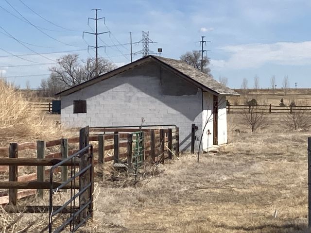
Building 1
| AccountNo | Building ID | Occupancy |
|---|---|---|
| R8984859 | 1 | Utility Building |
| ID | Type | NBHD | Occupancy | % Complete | Bedrooms | Baths |
|---|---|---|---|---|---|---|
| 1 | Out Building | 2801 | Utility Building | 100 | 0 | 0.00 |
| ID | Exterior | Roof Cover | Interior | HVAC | Perimeter | Units | Unit Type | Make |
|---|---|---|---|---|---|---|---|---|
| 1 | NA | NA | NA | None | 108 | 0 | NA | NA |
| ID | Square Ft | Condo SF | Total Basement SF | Finished Basement SF | Garage SF | Carport SF | Balcony SF | Porch SF |
|---|---|---|---|---|---|---|---|---|
| 1 | 704 | 0 | 0 | 0 | 0 | 0 | 0 | 0 |
| ID | Built As | Square Ft | Year Built | Stories | Length | Width |
|---|---|---|---|---|---|---|
| 1.00 | Utility Building | 704 | 1953 | 1 | 32 | 22 |
No Additional Details for Building 1
| Account | Parcel | Account Type | Tax Year | Buildings | Actual Value | Local Govt Assessed Value | School Assessed Value |
|---|---|---|---|---|---|---|---|
| R8984859 | 070519300003 | Agricultural | 2026 | 1 | 1,298 | 360 | 350 |
| Type | Code | Description | Actual Value | Local Govt Assessed Value | School Assessed Value | Acres | Land SqFt |
|---|---|---|---|---|---|---|---|
| Improvement | 4279 | FARM RANCH SUPPORT BLDGS | 1,280 | 350 | 350 | 0.000 | 0 |
| Land | 4147 | GRAZING LAND-AGRICULTURAL | 18 | 10 | 0 | 1.052 | 45,825 |
| Totals | - | - | 1,298 | 360 | 350 | 1.052 | 45,825 |
Comparable sales for your Residential or Commercial property may be found using our SALES SEARCH TOOL
Values are updated annually on May 1st for Real Property and June 15th for Personal Property and Oil and Gas.
| Account | Parcel | Account Type | Tax Year | Buildings | Actual Value | Local Govt Assessed Value | School Assessed Value |
|---|---|---|---|---|---|---|---|
| R8984859 | 070519300003 | Agricultural | 2026 | 1 | 1,298 | 360 | 350 |
| Tax Area | District ID | District Name | Local Govt Mill Levy |
School Mill Levy |
Estimated Taxes |
|---|---|---|---|---|---|
| 6828 | 0700 | AIMS JUNIOR COLLEGE | 6.313 | 0.000 | $2.27 |
| 6828 | 1051 | CLEARVIEW LIBRARY | 3.546 | 0.000 | $1.28 |
| 6828 | 0310 | EAST LARIMER COUNTY WATER (ELW) | 0.000 | 0.000 | $0.00 |
| 6828 | 1206 | LARIMER CONSERVATION DISTRICT | 0.000 | 0.000 | $0.00 |
| 6828 | 0301 | NORTHERN COLORADO WATER (NCW) | 1.000 | 0.000 | $0.36 |
| 6828 | 0517 | POUDRE VALLEY FIRE | 11.607 | 0.000 | $4.18 |
| 6828 | 0204 | SCHOOL DIST RE4-WINDSOR | 0.000 | 46.646 | $16.33 |
| 6828 | 0435 | TIMNATH TOWN OF | 6.688 | 0.000 | $2.41 |
| 6828 | 0100 | WELD COUNTY | 15.956 | 0.000 | $5.74 |
| Total | - | - | 45.11 | 46.646 | $32.57 |
The estimate of tax is based on the prior year mill levy and the 2025 projected assessment rates. Mill levies and tax estimates will be updated yearly on December 22nd for the current year. Additional information can be found at https://assessor.weld.gov
- 2025 NOV

- 2024 NOV
- 2023 (not available)
- 2022 (not available)
- 2021 (not available)
- 2020 (not available)
- 2019 (not available)